memes.cjtrowbridge.com
Category: Urbanism -> This Meme
llama-3.2-vision
This meme is a humorous illustration of a city plan, featuring a sprawling metropolis with numerous buildings, roads, and parks. The city is surrounded by a giant circle with a dotted line, implying that it's being "zoned" for some kind of development or expansion. The text overlay reads "ZONING" in bold, playful letters.
first-seen
2023-05-10T21:03:42+00:00
tesseract
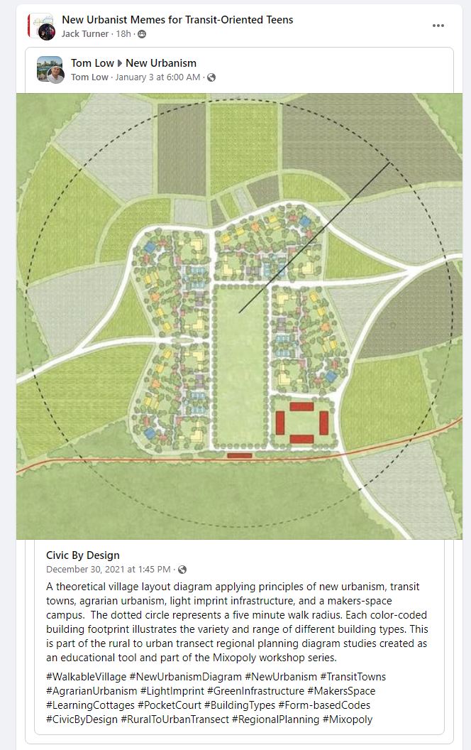
{ - 2. New Urbanist Memes for Transit-Oriented Teens ces @ ack turner ish-@ Tom Low > New Urbanism Tom Low : January 3 at 6:00 AM @ Sasie Ses ae ete Vein tessa tee Risse Uiiekey, — Ee 5 Sac 1 a at , Sh eee MRO eeasal 08. Dae: au\ee —_ Pra Ed equa ) ag” Beas sae le saa} tiles BLE § \ Ko i p: Rae E eS PO Civic By Design December 30, 2021 at 1:45 PM-@ A theoretical village layout diagram applying principles of new urbanism, transit towns, agrarian urbanism, light imprint infrastructure, and a makers-space campus. The dotted circle represents a five minute walk radius. Each color-coded building footprint illustrates the variety and range of different building types. This is part of the rural to urban transect regional planning diagram studies created as an educational tool and part of the Mixopoly workshop series. #WalkableVillage #NewUrbanismDiagram #NewUrbanism #TransitTowns #AgrarianUrbanism #LightImprint #GreenInfrastructure #MakersSpace #LearningCottages #PocketCourt #BuildingTypes #Form-basedCodes #CivicByDesign #RuralToUrbanTransect #RegionalPlanning #Mixopoly